Sea Warning Expected to be Issued for Typhoon Lekima on Aug. 7|利奇馬"持續增強 最快明天發布海警
發布時間:
更新時間:
Tropical Storm Lekima is approaching Taiwan. The Central Weather Bureau says it could issue a sea warning on Aug. 7. Starting on Aug. 8, the northeast region will experience heavy rain. On the 9th, the western and northeast regions will experience torrential rain. Meanwhile, a tropical depression is also strengthening near Guam, and could end up affecting Lekima's path
Tropical Storm Lekima is currently moving in a northwesterly direction at a speed of six kilometers an hour and is strengthening. The Central Weather Bureau forecasts the tropical storm will begin speeding up on the evening of Aug. 6 and approaching Taiwan. It expects to issue a sea warning as early as Aug. 7.
If the tropical storm moves along at our predicted speed and in our predicted direction, the Central Weather Bureau could issue a sea warning tomorrow during the day. The tropical storm is presently moving extremely slowly, and we forecast that it will begin moving faster in a northwesterly direction between late night tonight and tomorrow. This will affect the timing of our sea warning.
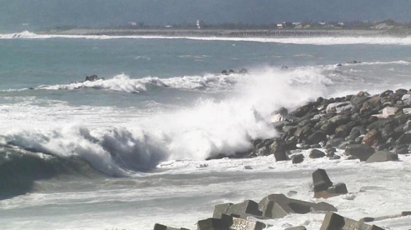
Starting on Aug. 7, the northeast region will begin feeling the effects of the tropical storm's peripheral cloud system. There will be intermittent rain as the storm approaches. Starting on Aug. 8, the northeast region will experience heavy rain. On Aug. 9, the western and northeast regions will experience torrential rain. It will also rain in other regions. The tropical storm will begin departing on Aug. 10, and its wind field will turn into a southwest wind and rain will continue in the southwest region. Japan, South Korea, and the United States have all forecasted that Lekima's path will take it right over Taiwan.
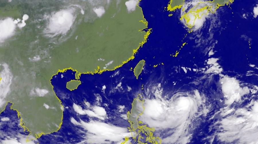
If the path shifts west, then it will get closer and closer to Taiwan. Present forecasts have the tropical storm affecting everywhere from the northern part of Hualien to the open sea. However, the majority of the weather forecasts of countries indicate the tropical storm will make landfall. There should still be some changes in the next 12 to 24 hours.
Experts say Typhoon Francisco, the eighth tropical storm or typhoon of the 2019 Pacific season, moved north after affecting Japan. The extension of a Pacific high pressure system westward will determine whether Lekima will get closer to Taiwan. Meanwhile, a tropical depression is developing to the north of Guam, and could develop into the 10th tropical storm or typhoon of the season within a day. It may also end up influencing Lekima's path.
輕度颱風利奇馬,移動速度相當緩慢,目前以每小時6公里速度,向西北西前進,強度還在持續增強,氣象局預估,颱風將在週二深夜開始加速,逐步接近台灣,氣象局最快會在週三白天,發布利奇馬颱風的海上颱風警報。
氣象局簡任技正 伍婉華表示:「如果颱風,依我們目前的方向速度預估,氣象局是可能在明天白天的時間,發布海上颱風警報,目前颱風,它移動的速度還是相當緩慢,我們預估在今天深夜到明天,向西北的移動速度才會比較快,這樣會影響到,我們發布海上警報的時間。」
週三起,北部東北部受到颱風外圍雲系影響,會有間歇降雨,隨著颱風接近,週四開始,北部東北部會有大雨,週五西半部和東北部雨勢較大,其他各地也會有雨,週六颱風開始遠離,風場轉為西南風,西南部地區仍會持續降雨。目前,各國對於利奇馬颱風的預報看法,其中,日本韓國和美國的預測路徑都是颱風中心會登陸到台灣陸地。
天氣風險公司總經理 彭啟明表示:「往西修正就是越來越靠近台灣,所以大概是,目前的預測大概(路徑),從花蓮的北部到外海都有,但是大多數的國家的氣象預報,都是指向會登陸,那未來大概12到24小時內,應該還有一些變動的空間。」
專家分析,今年第八號颱風范斯高影響日本後往北移動,太平洋高壓向西延伸後,將決定利奇馬颱風是否更接近台灣,另外,在關島北方也有熱帶低氣壓在發展,最快一天內就會發展成今年第十號颱風,整個大環境場的改變都會牽動利奇馬颱風走向。