TYPHOON MERANTI BRINGS HEAVY RAIN TO SOUTHEAST|莫蘭蒂來勢洶 宜花東.南台灣嚴防大雨


加入公視會員,
按讚收藏你關注的報導
發布時間:
更新時間:
Typhoon Meranti continues to move northwest, with the outer perimeter already over the Hengchun Peninsula. The eye is 100 kilometers off the southeast coast with winds at the center of the typhoon at force 17. The Central Weather Bureau estimates that wind speed at the center is 60 meters a second, and It is the strongest typhoon to impact Taiwan in 21 years. Ilan, Hualien, Taitung, Kaohsiung, Pingdong and the Hengchun Peninsula will all bear the brunt of heavy rain brought by the storm.
On the evening of Sept. 13, the outer perimeter of Typhoon Meranti reached the Hengchun Peninsula. Taiwan's southeast and south are bearing the brunt of rain. In Taitung's Dawu winds up to force 11 have been recorded. Ilan has recorded gusts of up to force 17. The Central Weather Bureau estimates the wind at the eye of the typhoon is moving at 60 meters per second. This is the strongest typhoon to affect Taiwan in 21 years.
==LUO YA-YIN CWB Forecast center technical specialist==
We estimate it will gradually move to the south of the Taiwan Strait. Areas to the south of Hualien, areas to the south of Taichung, Penghu and Jinmen will all come under the typhoon with maximum wind strength of force 7. Most recent data indicates that Lanyu has already experienced wind gusts of up to force 17.
Rain brought by the system has affected the whole of Taiwan. Pingdong, Hualien, Taitung and the Hengchun Peninsula are estimated to have at least 500 millimeters of rain, with even heavier rainfall of as much as 800 millimeters in the mountains. When the typhoon leaves on Sept. 15, there won't be much let-up in the weather, as Typhoon Malakas has already formed in the western Pacific and may follow Meranti's path.
==WU SHEN-YU Weatherrisk forecaster==
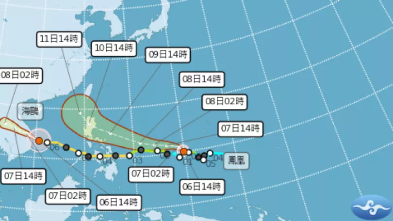
Typhoon Meranti will leave Taiwan on Sept. 15, and Typhoon Malakas will approach seas to the southeast of Taiwan on Sept. 16. From the latter half of Sept 16 to Sept. 17, it may approach Taiwan's east coast and turn north.
There are currently three typhoons in the western Pacific. The CWB has issued heavy rain warnings for the southeast of Taiwan.
TRANSLATED BY:CLARE LEAR
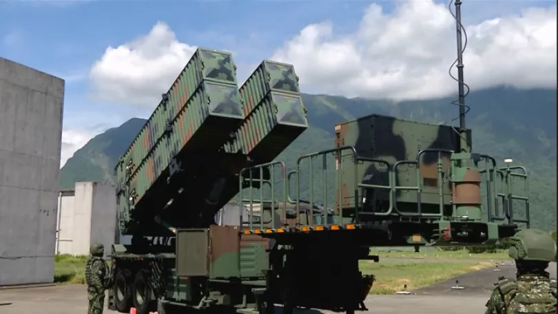
一袋又一袋的沙包,堆在七股沿海一帶,就怕中秋大潮跟降雨不斷,造成海水倒灌的狀況發生。強颱莫蘭蒂來勢洶洶,國軍總共動員3萬3千兵力,隨時支援災害搶救。
隨著颱風逐漸靠近恆春半島,入夜之後,暴風圈碰觸陸地,迎風地區風勢會更大,恆春半島及台東會出現9到11級陣風,而綠島、蘭嶼則可能會出現17級以上的強陣風,明天全台都會感覺到風雨。
==氣象預報中心技正 羅雅尹==
從今天的深夜到明天的一整天
還有15號的上半天
是颱風距離我們最接近的時候
首先最要提醒的還是
主要以迎風面的整個
東半部到恆春半島 蘭嶼 綠島
緊接著是南部地區
這些地方的影響程度會是最大的
暴風圈接近台灣,帶來的雨量也不容小覷,[[CG IN]]受外圍環流影響全台有雨,迎風面像是屏東、花蓮、台東及恆春半島,預測總雨量可達500毫米,而山區降雨會更多,上看800毫米。[[CG OUT]],但週四颱風離開之後,恐怕還不能鬆懈,因為第十六號颱風「馬勒卡」已形成,而且可能會尾隨在莫蘭蒂後,朝台灣而來。
==氣象分析師 吳聖宇==
在莫蘭蒂颱風前腳剛走
就是禮拜四15號它剛離開
它(馬勒卡)很快在禮拜五
就要接近台灣的東南方海域
不能排除說它有可能在
禮拜五的下半天到禮拜六
甚至到禮拜天這段期間
它會通過台灣東部的近海
然後往北上
目前太平洋上同時存在三個颱風,專家指出,馬勒卡可能在週末,最靠近台灣東北部,至於接下來的路徑還得持續觀察。而氣象局也針對,恆春半島、臺東、花蓮、宜蘭及高屏東地區,發布大雨特報,並提醒民眾要嚴加戒備。
記者 王柏文 溫正衡 林國煌 台北台南報導