TYPHOON MALAKAS MOVES ON NORTH, LEAVING UNSTABLE WEATHER UNTIL MONDAY|台灣本島脫離暴風圈 馬勒卡陸警解除


加入公視會員,
按讚收藏你關注的報導
發布時間:
更新時間:
Typhoon Malakas has continued on its northeast track. Taipei City, New Taipei City and Keelung are out of the storm radius and at 2:30 this morning the land warning was lifted by the Central Weather Bureau. The marine warning will probably be lifted later this morning. The CWB said there will be unstable weather across Taiwan today, with rain in mountainous areas. Weather will become more stable tomorrow, just in time for work.
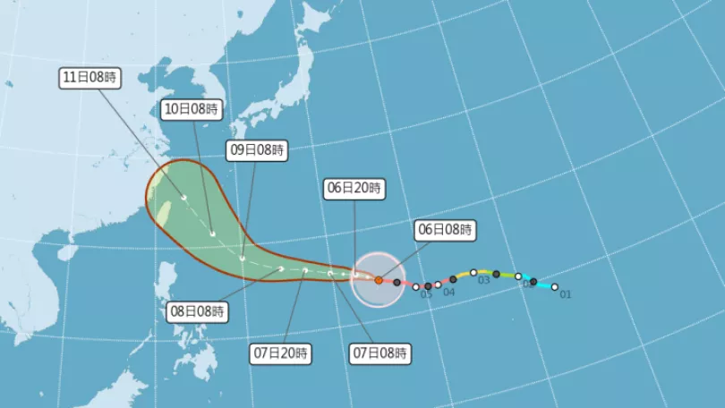
Typhoon Malakas has moved north, so that Taiwan is now out of the direct storm system. The Central Weather Bureau lifted the land warning at 2:30 am this morning. The eye is currently located over the sea to the northeast of Taiwan moving at 13 kilometers an hour to the north-northeast. It will gradually turn northeast and move towards Japan. The CWB says that Taiwan will still be affected by the outer storm system and weather across the whole island will be unstable. Mountain regions to the north of Chiayi and the Tainan area will be affected by heavy rain.
==CHEN YI-LIANG Central Weather Bureau forecast technician==
The CWB has issued heavy rain warnings extending from New Taipei City mountain areas to Miaoli mountain areas where there will be heavy localised rain showers. In the afternoon Hualien and Taitung will have heavier rain and we ask the public to take precautions.
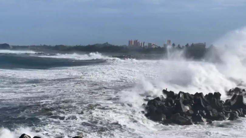
With the impact of Typhoon Malakas over the past two days, Youkeng in Taipei City's Beitou district amassed 370 millimeters of rainfall, the most in Taiwan. Zhuhu, also in Beitou, and Yangminshan all had around 300 millimeters of rain. In the south, Chiayi's mountain districts had over 250 millimeters of rain over consecutive days. The CWB warned against collapsing embankments, rockslides and mudslides. Along coastal areas there are still strong winds and high waves and the public should avoid beaches.
==CHEN YI-LIANG Central Weather Bureau forecast technician==
Before the typhoon has completely moved away we remind the public that there are still strong gusts of wind along coastal areas and heavy rain inland.
The CWB estimates that weather will stabilise on Monday. However, for the next few days, there will be a strong northeast wind and there will be showers in the east and north of the island. The CWB predicts that the typhoon will weaken as it moves north and the marine warning for Taiwan will be lifted this morning.
TRANSLATED BY:CLARE LEAR
中颱馬勒卡,持續往東北移動。隨著北北基地區脫離暴風圈,今天凌晨2點半,全台已經解除「陸上颱風警報」。預估上午也將解除海上颱風警報。氣象局提醒,今天受到颱風外圍環流影響,各地天氣還是不穩定,山區更要嚴防大雨,預計要到星期一才會穩定一些。
臺灣本島已經脫離馬勒卡颱風的暴風圈。氣象局在今天凌晨兩點半,解除馬勒卡的陸上颱風警報。颱風中心目前位在台北東北方海面,以每小時13公里速度,向北北東移動。接下來路徑會逐漸往東北轉,朝日本方向前進。氣象局提醒,受到颱風外圍環流影響,全台天氣還是不穩定;嘉義以北山區和台南地區,以及花東地區,特別要嚴防大雨。
==氣象預報中心技正 陳怡良==
氣象局也發布大雨特報提醒大家
新北市的山區一直到苗栗的山區
還是有機會出現局部性大雨
午後花蓮以及台東地區
有機會出現比較大的雨勢
這點我們還是要請朋友們小心
這兩天受到馬勒卡的影響,台北市北投區油坑累積雨量已經超過370毫米,高居全台之冠。同樣是在北投的竹湖、陽明山等地區,也測到300毫米左右的雨量。南部嘉義山區則累積超過250毫米,連日降雨,氣象局提醒民眾,應注意坍方、落石、土石流;另外,沿海還有強風和大浪,也盡量避免前往海邊活動。。
==氣象預報中心技正 陳怡良==
不過颱風完全遠離以前
我們還是提醒大家
還是要特別留意
它所殘留下來
沿海還是有較強陣風
陸地上一些比較大的雨勢
氣象局預估,星期一天氣才會比較穩定些,不過,接下來幾天,東北風會稍微增強,東半部及北部還是有短暫陣雨。
氣象局認為,颱風持續北上後,海洋條件將不利馬勒卡繼續發展,暴風圈和強度可能會減弱,預估今天上午,也將解除海上颱風警報。
綜合報導